
260
Clients Served

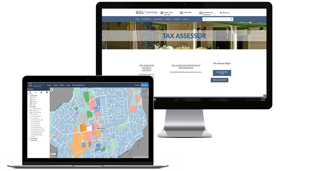
Dynamic Maps
Overlay multiple satellite maps to view changes to properties over time.

Collaboration
View Construction Department information in real-time to get updated information about properties.
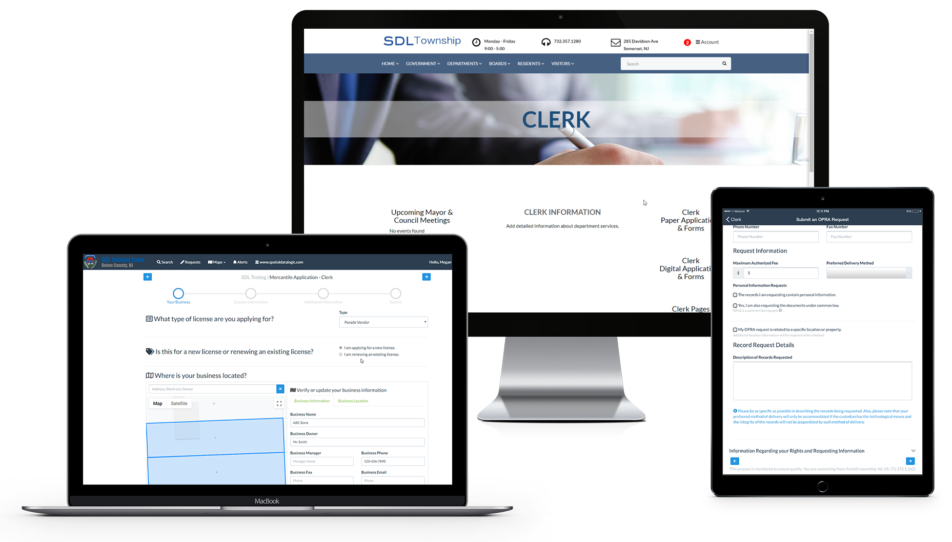
How SDL Makes Your Job Easier
STAY INFORMED
Access construction permits and track final inspection dates to prioritize properties for reassessment
MOD-IV TAX DATA
Import MOD-IV tax data from your current system. Access data with an easy to use interface for sorting, grouping and searching specific properties
COLLABORATION
SDL modules work together to provide a comprehensive view of property history. Assign tasks, track status changes and view property history across departments
ADDITIONAL LOTS
Link additional lots to “lead parcel” for easy access and billing
GIS MAPPING
Town map linked to property information and documents. Overlay visual layers such as flood zones, waterways, terrain, land value and building type